You’ve seen the reports: South Carolina is at risk of severe weather on Thursday.
But, what does that mean?
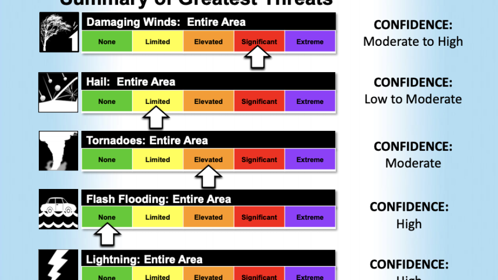
As a cold front moves across the southeast, the National Weather Service’s (NWS) Storm Prediction Center placed South Carolina under a “moderate” risk of severe weather on Wednesday. While “moderate” doesn’t sound like much of a threat, if placed on a five-point scale, it would rank four points, falling immediately below the highest risk.
Unlike Charleston’s typical flash floods, the weather system moving towards SC will bring a heightened threat of damaging gusts of wind, large hail + tornadoes. 🌪️
The severe weather is predicted to increase during the afternoon + evening, specifically 3-8 p.m. along coastal areas. During this time, it’s likely to see downed trees + power lines which can cause potential power outages.
While it is advised not to panic, it’s important to be prepared in case of weather incidents.
NWS reminds us to have a plan in place, including a safe place to take shelter + reliable ways to receive warnings, such as phone alerts.
See National Weather Service’s full report on Charleston here + follow along with local weather alerts here.


